 Champions League
 Premier League
 La Liga
 Saudi Pro League
 Bundesliga
 Serie A
 Europa League
 Egypt Premier League
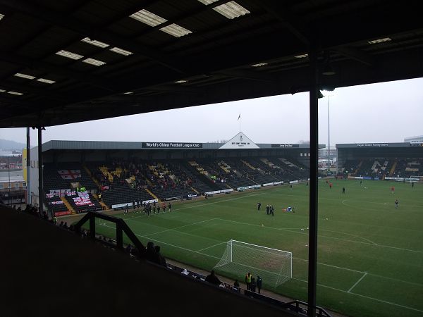
Meadow Lane
How to get there, where to stay nearby and what is around the ground.
 Notts County
- Nearest stop
- Nottingham StationTram, 9 min walk
- Nearest airport
- Nottingham City AirportNQT, 4.6 km
Meadow Lane is in Nottingham and holds 19,588 people. Notts County play their home matches here. This guide covers where to stay close to the ground, how to find it and which matches are coming up. Also known as Meadow Lane Stadium.
Meadow Lane: location and hotels nearby
The pin is the stadium. The prices are hotels around it. Areas to stay: The Meadows, Pelham Waterside, Yacht Club Place.
Prices near a stadium jump on matchdays. Book once the fixture date is confirmed, and choose free cancellation in case the kickoff moves for TV.
Getting to Meadow Lane
The nearest stations and stops, with the walk from each to the ground.
- Meadow Lane
- 3min Eugene GardensBus 224 m
- 3min Ryehill StreetBus 269 m
- 9min Nottingham StationTram 737 m
- 9min NottinghamTrain 744 m
- 11min Queens WalkTram 878 m
Around Meadow Lane
Pubs, restaurants and cafés within a 10-minute walk of the ground, and what else to see nearby.
- Meadow Lane
- 1min Crafty WarehousePub 70 m
- 1min Meadow Lane Sports BarPub 81 m
- 2min Trent NavigationPub 160 m
- 3min Silly Sausage CafeCafé 213 m
- 3min Spud Bros ExpressCafé 250 m
- 4min Nottingham Forest MuseumSight 343 m
- 13min Governors HouseSight 1 km
- 13min Judges Retiring RoomSight 1 km
- 13min National Justice MuseumSight 1 km
Within a 10-minute walk: Pubs and bars 24, Cafés 18, Fast food 24, Restaurants 7, Supermarkets 3.
Places and distances from OpenStreetMap (© OpenStreetMap contributors). Distances are straight-line; the walk is an estimate.
About Meadow Lane
Next matches at Meadow Lane
No match is scheduled here yet. Notts County
Questions and answers
Where is Meadow Lane?
Meadow Lane is in Nottingham (Meadow Lane). The map on this page opens in your maps app for directions.
How do I get to Meadow Lane by public transport?
The nearest train stop is Nottingham, about 9 minutes on foot from the ground (744 m).
Which airport is closest to Meadow Lane?
Nottingham City Airport (NQT), about 4.6 km from the ground.
Where can I eat and drink near Meadow Lane?
Within a 10-minute walk of Meadow Lane there are 24 pubs and bars, 18 cafés, 24 fast food, 7 restaurants, 3 supermarkets. The closest: Crafty Warehouse, Meadow Lane Sports Bar, Trent Navigation.
Is there parking at Meadow Lane?
OpenStreetMap lists 116 car parks within 800 m of Meadow Lane. On matchdays they fill early; public transport is usually quicker after the final whistle.
What is the capacity of Meadow Lane?
Meadow Lane holds 19,588 spectators.
Which team plays at Meadow Lane?
Notts County play home matches at Meadow Lane.
When did Meadow Lane open?
Meadow Lane opened in 1910.
What else is Meadow Lane called?
Meadow Lane is also known as Meadow Lane Stadium.
Where should I stay for a match at Meadow Lane?
Stay within walking distance of Meadow Lane so you can walk back after the final whistle, when transport is at its busiest. The map on this page shows the hotels around the stadium with their prices.